Showing posts with label BRT. Show all posts

Wednesday, March 27, 2013

Potomac Yard groundbreaking along East Glebe Road

After an earlier report from the UrbanTurf blog that reported a mid-2012 project start, MRP Realty and the JBG Companies announced the start of construction on The Alric, the first phase of The Exchange at Potomac Yard. 

The Exchange at Potomac Yard is a 14-acre Town Center parcel within the overall 300-acre Potomac Yard community in Alexandria, Va. The Exchange will be developed by both JBG and MRP and will comprise nearly 2 million square feet of retail, office, hotel and residential space. 
Located in the heart of The Exchange at Potomac Yard, The Alric will be a 323-unit, Class A multi-family apartment development. It is located at 731 Seaton Ave., adjacent to the future Potomac Yard Metro Station with Yellow and Blue Line service, and within minutes of historic Old Town, the Pentagon, Crystal City and Ronald Reagan Washington National Airport. The project will feature a mix of studio, one- and two-bedroom residences in dual five-story buildings that are separated by a public mews. The Alric is expected to be completed by the end of 2014.

The project, designed by SK&I Architectural Design Group (designers of the Madison by Braddock Road Metro and Lofts 590 in Crystal City), will include a roof terrace with an indoor lounge that offers spectacular views of the Washington skyline and the Potomac River. Additionally, the community will offer internal courtyards, private patios on the ground level, extraordinary common area amenities for its residents, a pool, and outdoor seating areas.

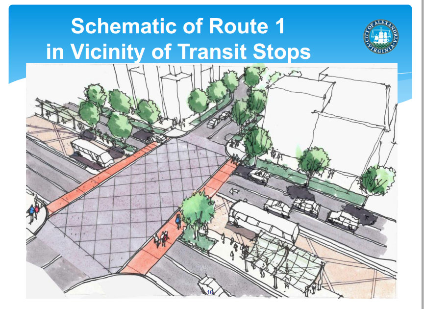
In addition to Pulte’s high-end townhome and condominium development to the south of The Alric, a neighboring 24-acre public park with playgrounds, playing fields, tennis, basketball and volleyball courts and a bike trail that connects with the Mount Vernon trail will be completed this summer. Prior to delivery of the new Metro station, Potomac Yard will also feature Bus Rapid Transit (BRT) service on Route 1 connecting Crystal City to Old Town Alexandria.

Thursday, March 14, 2013

The Birth of the SuperStop

ARLnow.com reports on the first ever "Super Stop" that has now been put into operation along Columbia Pike in Arlington (Walter Reed ‘Super Stop’ Now Open):
The first of 24 planned “Super Stop” bus stops on Columbia Pike opened this morning.
The stop, on Columbia Pike at the intersection with Walter Reed Drive, offers riders a brighter, more open and attractive take on the traditional sheltered bus stop. The stop features lighting, an electronic display that shows when the next buses are coming, and a number of unbranded newspaper boxes (not yet filled).

Arlington TV had this video presentation of the proposed series of Super Stops:

Newsmakers: Super Stop


Previous related stories from The Arlandrian:

Friday, March 08, 2013

Name the BRT!

One proposed design and name

In addition to helping to pick the look and color of the BRT vehicles and signage, WMATA, Arlington and Alexandria are also asking for the public's input on the name of the system. The current front runner's are either "MetroWay" or "Metrobeat", but other options can be suggested through write-in voting. We're partial to "BuRT" or "BuRsT".
Metro is asking area customers and residents to participate in an online survey that will shape the look and feel of future "bus rapid transit"services in the region.
Together with Arlington County and the City of Alexandria, Metro is preparing to introduce the region's first bus rapid transit system along a five-mile route between Braddock Road and Crystal City Metrorail stations. Buses will operate frequently along dedicated roadways, separated from other traffic, for eighty percent of their trip, meaning more frequent and reliable service with fewer delays. The buses will also make fewer stops, serving 17 "stations" that feature more amenities than standard bus stops.
To further reduce trip times, customers will pay for their trip prior to boarding the bus at off-board payment stations that accept SmarTrip, cash, debit or credit cards.
Illustration of BRT in Crystal City

Monday, March 04, 2013

BRT: Coming First to Arlandria

A "D.C. area" first that's not in D.C.

The Washington Post has coverage of the BRT (bus rapid transit) system currently under development in area along the Route 1 corridor between Braddock Road and Crystal City Metro with future plans for expansion and realignment. Although originally promised for this December, opening is now slated for early next year (D.C. area’s first bus-only lanes under construction in Northern Virginia):
"A five-mile stretch in Arlington County and Alexandria could soon be a bus rider’s dream come true: Forget the long waits at the bus stop and the time wasted in traffic. 
Next year, Metro officials plan to launch a bus service connecting the Braddock Road and Crystal City Metrorail stations. And they are not talking about ordinary service. These buses would travel much of the route traffic-free in what is to become the region’s first buses-only lanes."
WMATA, Arlington and Alexandria are also asking for the public to help design the appearanceof the vehicles and the layout of the information boards at the transit stops. Help design the first BRT system in our region. Complete the survey today.

Also, to get an idea about how BRT works, check out this video of a similar project in San Francisco:

Vision of Bus Rapid Transit (BRT) for San Francisco


Saturday, January 19, 2013

How will Alexandria's BRT fare?

In a post on Greater, Greater Washington, Dan Malouff discusses what's been called "BRT Creep" (The US has only 5 true BRT systems, and none are "gold" - Greater Greater Washington). That's the term some streetcar enthusiasts use to explain their reasoning for preferring rail over wheels transport. Dan writes:
"The same community leaders who choose BRT over rail, because BRT is cheaper, then make the same choice when faced with other potential cost-cutting measures. They eliminate the most expensive features, until the gold standard that was promised isn't actually what's delivered."
He points to a study by the Institute for Transportation & Development Policy (ITDP), that reviewed all of the existing BRT projects in the US. Dan points out:
"When new bus rapid transit lines are discussed, proponents often say they hope to make the routes gold standard, meaning so high-quality that they mimic many features of rail. That's a high bar; most BRT projects in the United States don't even qualify as true BRT, and so far not one has actually met the gold standard....So far, only 5 lines in the United States have scored highly enough to qualify as true BRT, and all 5 rank at the bronze level. Not one is even silver, let alone gold."
This begs the question, how well rated is the The Crystal City/Potomac Yard Transit Improvement project currently under construction along Route 1? Or at least the Alexandria portion of it?

We discussed this project before on the Arlandrian: Alexandria Has Some Catching Up To Do. Route 1 Would Be a Good Start. and Alexandria's Update on Route 1 Bus Rapid Transit Plans. And there's a great discussion of it in the City's presentation from last Spring. But we haven't looked at how this project might compare to rail. What level of BRT will we be getting? Gold, Silver or Bronze. Or does the project even meet the ITDP criteria for BRT at all?

Well, ITDP has a handy scoring sheet. Who's up for rating the CCPY BRT?


Wednesday, January 16, 2013

Regarding our evolving transit structure

 On Greater, Greater Washington, Agnes Artemal talks about the developing framework of BRT and streetcar systems being implemented immediately around us and the challenges faced by the various jurisdiction to coordinate these lines.
"To get streetcars across boundaries, however, the many local governments must coordinate their plans and deal with differences in their abilities to fund projects."
Arlington County's streetcar plans
Bright hopes, some obstacles for Northern Virginia streetcars - Greater Greater Washington

Thursday, April 19, 2012

Alexandria's Update on Route 1 Bus Rapid Transit Plans


View of Route 1 at East Glebe Road

In April 2011, City of Alexandria City Council approved building a Bus Rapid Transit facility within the median  Route 1 as part of the Crystal City-Potomac Yard (CCPY) Transitway, a 5-mile length of priority transit service between the Pentagon City and Braddock Road Metro Stations.

Alexandria is paying for the Route 1 portion with $8.5 million dollars of federal stimulas TIGER grant. On Route 1 the BRT is a portion of the CCPY from Potomac Avenue to East Glebe Road. The Design-Build contract was awarded in November 2011 and construction is scheduled to begin in July 2012,
with an opening date of December 2013.


Last night, the City provided this update on the progress.

Sunday, December 04, 2011

Arlandria: When A Plan Comes Together

With all eyes either gazing in adoration or glazing over in rage at the waterfront plan, a small, community-spurred plan to bring about changes in a struggling, but hopeful neighborhood has finally come to fruition.

The Long Road

The Vision from the 1998 Plan.
The Arlandria community has been planning for change longer than any other neighborhood in Alexandria. We are now a decade into implementation of the Arlandria Revitalization Plan, the result of the City and community-supported 5-year planning effort from 1998 to 2003. Broadly stated, the goal of the Plan was to build on the strength of Arlandria as a pedestrian-oriented, mixed-use place through the redevelopment of underutilized sites. Re-development of the "oppurtunity sites" was the anticipated catalyst for the proposed revitalization.

Absent that outside investment, the City pursued modest improvements, but the opportunity to make a significant impact in a densely poor community was limited. Resources were put into an interim marketing strategy to strengthen existing businesses and community members worked to establish facade improvement guidelines for individual storefronts. But the efforts proved to be futile since many shopowners were barely breaking even. In the decade since the plan, shops were closing and turning over at an increasingly alarming rate. The shopowners that remained were barely holding on.

Redevelopment proposal compared to Arlandria Plan illustration
A 2008 follow-up feasibility study, publicly unveiled 3 years ago, ultimately confirmed that conditions in Arlandria made development unfeasible. Paraphrased, "Arlandria was not worth the investment." The study pointed to an on-going perception of crime, a poor built environment, and lack of economic diversity as the three major impediments to economic development.

Grass-Roots Community For All

The City attributed the stagnant plan implementation to a lack of community involvement. That comment and the implication of the feasibility study became the catalyst for the community led, city-supported grassroots efforts that followed. Within the parameters of maintaining the ethnic and economic diversity that define Arlandria, achieving sustainability became the overarching goal. Without outside investment, a group of volunteers took on the challenge of what remains a higher standard of fostering a supportive environment. Working hand-in-hand with neighbors and social service providers, community residents created a small business incubator in the farmers and artisans market. The Four Mile Run Farmers and Artisans Market is the sole market - in both Alexandria and Northern Virginia - to welcome SNAP (food stamps), a labor of love which took market organizers countless extra hours to establish and staff weekly. And the community has banded together to improve streetscapes and parks and maintained a presence at service provider and quality of life meetings to ensure every resident and visitor feels safe in our community.

Along with the City, the neighborhood paved the way by working with our Community Oriented Police (COPS), ARHA, Community Lodgings, Wesley Housing, the Community Services Board, the Chirilagua Coop and most recently Arlington Housing Corporation to preserve existing housing and conditions for the city's most vulnerable citizens, and have strongly supported the inclusion of workforce housing to create upward mobility for hard-working residents - who would otherwise have to leave the City to improve their circumstance. According to Census, Arlandria's population is still highly transient (30% turnover per year, 90% every 5 years). The city and grassroots organizations have aimed to create an environment that allows more residents to make Alexandria into a long-term home by providing a wide range of housing. That solution requires something more than very low rent and very high cost properties. Economic diversity and livability are key to a sustainable community.

Finally...

The long-awaited plan to re-develop the Arlandria Shopping Center (Mount Vernon Village Center) overcomes the challenges presented in the feasibility study from 3 years ago. After years of painstaking, frustrating and sometimes seemingly futile efforts, one of our community partners has proposed the first step towards fulfillment of a decade-old promise to realize Arlandria as the proud waterside gateway into our wonderful city. In a constrained-resource environment, Arlandria Center, LLC has created a design that addresses the key issues in our neighborhood. It leads the way by making a positive change to the built environment and addresses the perception of crime by adding eyes on the street - where increased vitality becomes a deterrent to crime.

This current development application addresses many of the design goals of the Arlandria plan, proposing a mixed used property consisting of two multi-family residential buildings that maintain the 50,000 sq. ft. of retail along Mt Vernon Avenue (maintaining approximately the same amount of retail). Parking would be underground or buried within the building at grade. The plan includes streetscape improvements to Mt Vernon Avenue and Bruce Street, which include street trees, new bus shelters, and sidewalk widening. The high quality, contemporary design is in compliance with new green building standards and incorporates new affordable housing units for households earning less than 60% of the Area Median Income. The property also improves access to and increases visibility of Four Mile Run Park.

The Mt. Vernon Village Center proposal for 450+ housing units is a first step on a long road to alleviate an impending housing crunch. The median age of housing stock within one mile of the project is 55 years old; within 5 miles: 44 years old.

The development would also provide the city-code required 940 underground parking spaces. The project remains open to utilizing some parking spaces for other subsequent developments if the opportunity presents itself.

And the proposal includes a phased approach, retaining as much existing retail as possible during construction. MOM's and CVS, for instance, could continue to operate if they choose on the northern portion of site while the southern portion is built.

Community Benefits

The plan fulfills the Arlandria Plan requirement for 10-15% open space: 10% of the property space would be reserved for public open space and another 5% would be for resident use. The building would be set back back 40 feet from Mt Vernon Avenue for pedestrian plaza space and will be pulled back 5 additional feet on Bruce Street to create better access to Four Mile Run Park and better vehicular access to stores and residences. The project would also fund up to $200,000 for new tennis/basketball courts, which would be relocated per the 4MR Park master plan. 7,000 square feet of the property along the park would be reserved for a pedestrian promenade with the potential for a future road should the City desire at some point. The development would also improve the quantity and quality of stormwater runoff from the site.

The primary entrance to the residential portion of the parking garage would be through the center courtyard aligned across from Russell Road and the developer would rebuild that intersection and the southern entrance to the property for better automobile access than exists today.

The development conforms to all of the standards set out in terms of bulk, set back and open space, but needs to be 7 additional feet taller in the center of the building to achieve the scale need to accommodate 28 units of affordable housing throughout the property. This housing which would be open to holders of housing vouchers and others who make less than 60% of Area Median Income.

The residential portion of the property would be built to LEED green building standards, and the commercial portion would be build to LEED Silver standards.

The project also includes $51,000+ in today's dollars (adjusted for inflation) annually for transportation management to keep single occupancy vehicle trips from the development to less than 40% of total trips. To help accomplish that, the developer would additionally install new bus shelters with real-time bus arrival data and would also install on-site bicycle amenities, including a Capital Bikeshare station. The developer would also provide a 20% employee transit subsidy. In the future, the development would be required to partner with other property owners to create a Transportation Management District to make further improvements to transit.

A little mentioned project attribute is that it also meets the design guidelines from the Four Mile Run Restoration Plan. This plan was created by the community over several years as joint effort between the City and Arlington County working through the Northern Virginia Regional Commission. See examples of suggested architecture and building massing in the following excerpts:

Challenges and Opportunities

"Neighborhoods that mix land uses, make walking safe and convenient, and are near other development allow residents and workers to drive significantly less if they choose. In fact, research has found that in the most centrally located, well-designed neighborhoods, residents drive as little as half as much as residents of outlying areas. Along with these benefits, mixed-use development can improve communities in other important ways, including supporting affordable housing by lowering transportation costs. Studies have also shown that mixed-use development, especially in concert with other smart growth strategies, provides significantly higher returns to local governments through property and sales taxes while requiring lower per unit infrastructure and public-service costs." (EPA)

The majority of road issues in our area are rush hour bottlenecks further on down the line, such as where West Glebe and South Glebe come together and where those roads hit Route 1. There is the need for targeted solutions for those bottleneck areas as well as better transit and bike options to allow people to switch modes away from single occupancy vehicle driving. Mt. Vernon Avenue in Arlandria is not a highway, nor even a high capacity road. At its best, it could be an urban boulevard with wide sidewalks, easy pedestrian crossing places, and slow moving traffic. The Arlandria Plan vision of pedestrian-oriented, transit-oriented development is the antidote to the bottlenecks problems created by sprawl induced cut-through traffic. 

Post rush hour traffic on Mt Vernon Avenue
9:15 on a Friday morning.

The small area plan is about making a pedestrian friendly community that brings current and future residents out on foot to enjoy the neighborhood. Right now, we are bathed in a sea of empty parking lots and people-second design. Bus routes connect the Avenue to points south and north, the Metro stations and the Pentagon. "Circulator" routes from a future Potomac Yard Metro and to the future transit line along Route 1 are in the works, but this will only work if complimented with sufficient density.

In order to maintain our diversity, we have made a conscious decision that we would prefer to add the density of economic diversity that mitigates the negative impact of being the most impoverished community in the city. The development proposed by the Mt. Vernon Village Center helps us realize our long-awaited goal of becoming a safe, walkable, sustainable and inclusive community. We are proud of our multicultural environment, we have immigrants from around the world, but without the proposed development, the opportunity to fulfill Arlandria's potential will likely slip by and drive our neighborhood back to it's 'unfeasable' state. What we have learned through our journey is that every resident has a stake in making their own neighborhood the best it can be. All of us have a responsibility to step forward with an investment of the time it takes at least pay attention to the opportunities presented in their area. Whether it's the city or a developer considering making a change, make your voice heard. We feel strongly that this is the best opportunity to make Arlandria one of the City's greatest success stories. If you believe that too, now is the time to step forward, write a letter, show up, or even join in. Everyone's welcome - it's Arlandria!
___________________________________________
Submitted by Kevin Beekman, Melissa Garcia and Nick Partee

Saturday, January 22, 2011

The Arlandrian News Round-Up: Transportation, more Transportation... and Other News

Cry, or shed a tier... The City approved the first tier of a special tax district, a $0.20 per $100 assessed value tax on Potomac Yard properties, that will help fund the in-fill Potomac Yard Metro station.  A second tier on the nearby Potomac Greens neighborhood is also part of the overall funding plan (though not approved).  This 2nd tier is highly contentious, and other, more diffuse options are being considered.  Vice Mayor Kerry Donley makes the case (Alex Times) that we must to be willing to pay for the modernization of our transportation infrastructure if we don't want to be left behind in the region.  He also opines, correctly, I think, that we the taxpayers will get a nice return on investment.

Roads are for all modes  At the last Transportation Planning Commission meeting, City staff fought the idea of taking a Complete Streets zoning ordinance amendment to City Council in favor of a less binding Resolution.  They worry a zoning ordinance amendment would not be flexible enough for some of Alexandria's narrow streets.  You would think a well-written ordinance would take different factors, like available right-of-way, into account.  If the City desires complete streets, they should make that policy binding, not just a general guideline. See more, as local blogger "Froggie" has a great write-up.  (Froggie's Blog)

BRT for you and me? I haven't seen a great write-up of this, but Alexandria received money as part of the stimulus package to install separated BRT (and hopefully eventual streetcar) lanes in the Route 1 Transportation Corridor. (NBC Washington)

Batter Up!  Georgetown Baseball and Softball is looking for a new place to play, and Pat Malone and Frank Fannon could be close to making our very own 4 Mile Run Park their new home plate as soon as 2014.  Whether or not you worry about losing public playing fields, you have to admit that it could be very good for Alexandria's biggest... and most neglected park.  (Del Ray Patch, Washington Post)

What's Up With Stream Restoration  The Four Mile Run Joint Task Force has a meeting and open house this Wednesday, Jan 26.  Located at the Fairlington Community Center (map).  See more details about the meeting here, though there's not too much info.  Head over and find out how 4 Mile Run stream restoration work is going!

Monday, November 16, 2009

Tram-sportation For Alexandria

Update: Time of event is 7pm, not 6:30. There were two different times listed in various places. I double-checked this with NVSC.

Streetcars, aka trams, are a hot topic in the news recently. They helped form the communities that we now think of as some of the most livable, walkable areas in the Washington, DC area. Some 70 years ago, they fell out of fashion through very questionable actions by the automobile, electrical, and oil industries. It seems they are coming back to the area, so why not here?

The Columbia Pike streetcar project is moving along. Alexandria, Arlington, and parts of Fairfax county make perfect sense as future phases of an eventual Northern Virginia streetcar network.

The newly formed Northern Virginia Streetcar Coalition (NVSC) wants to build momentum for this resurgent form of transit that can get you from Metro or VRE to your doorstep (facebook group).

NVSC is holding a kickoff meeting this Wednesday, Nov 18 @ 7pm in Room 158 of Northern Virginia Community College's Bisdorf Building (map). Speakers will include Chris Zimmerman from the Arlington County Board and Stewart Schwartz, the Executive Director of the Coalition for Smarter Growth.

To whet your appetite and catch you up a bit, here is a roundup of recent news and information about streetcars. You can also find lots of links on NVSC's facebook group page, linked above.
Done right, streetcars induce mixed-use “transit-oriented development” that accommodates growth while enhancing livability and reducing pollution and greenhouse gas emissions. Streetcars can promote street life, define neighborhoods, reinforce retail, and fit easily into built environments with little disruption to existing businesses, residents and traffic. They help create places where people want to be.
Simulated Photo from www.piketransit.com

So if you'd like to get involved with this group, just show up November 18th. You can RSVP to NOVAStreetcar@aol.com, though nothing says an RSVP is required.

Friday, July 17, 2009

Alexandria Has Some Catching Up To Do. Route 1 Would Be a Good Start.

During a recent presentation by the Mayor's Institute on Design to Alexandria City staff, Christopher Leinberger compared Arlington to Alexandria in a way that really struck home.

Paraphrased, he said that while Alexandria has really excelled at preserving the past, Arlington has outpaced Alexandria in building for the future. While Alexandria should preserve its history, much of Alexandria land-use is stuck somewhere between the 1950s and today, complete with suburban development patterns and car-serving business and industry.

Somehow, Arlington just seems to come up with good ideas to produce a more pedestrian-friendly, urban environment. Take the latest example: Arlington wants to assume control of Columbia Pike from VDOT to expedite the realization of their vision for the corridor (tip: DCMud). They're spending most of the money, they have the plans, so why should they have to wait on a highway and suburbia happy institution and jump through hoops to realize that plan?

Alexandria has a transportation plan that finally incorporates multi-modal transportation instead of focusing entirely on roads. Part of this plan is to develop BRT or streetcars on and around Route 1 between old town and the Arlington border (extended into Crystal City and Pentagon City by Arlington). Were Alexandria to look extensively into land use planning during their transportation planning process, they could turn the meeting point of Potomac Yard, Del Ray, and the North End neighborhoods (Arlandria et al) into a lively, walkable area.

Property value and potential land-use flexibility for land adjacent to Route 1 suffers from the roads use as an suburban-style highway as opposed to an urban street (2006 WashPo article). The road is "a hostile environment", as stated by then Planning Commission Chair Eric Wagner. Alexandria needs to expedite the process of transforming this highway back to a street. This means both the street and the land surrounding it needs to be re-envisioned. This site discusses plans for the street, now the west side of Route 1 needs a comprehensive plan (note: The Crystal City/Potomac Yard Transit Improvement project focussed on BRT, though streetcars are still under consideration. Here's a GGW article comparing the two).


With so much investment coming into Potomac Yard, Alexandria's treatment of Route 1 has a big say in its success, and the impression Potomac Yard redevelopment will leave on the neighborhoods to the west of the highway. Will Potomac Yard turn into a welcoming city that flows seamlessly into nearby neighborhoods or a isolated island of concrete on the other side of a very intimidating highway?

Kudos to Arlington for this creative way to expedite walkable street progress. Alexandria could learn a few things from Arlington's willingness to figure out ways to get things done (decades of waffling on Potomac Yard Metro, anyone?).